Automated Feature Extraction
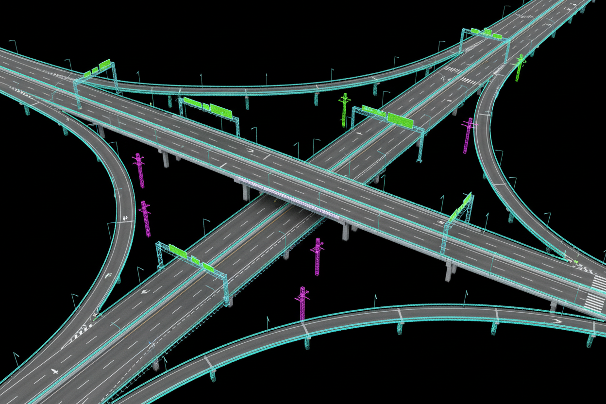
Our AI-powered extraction engine automatically identifies, classifies, and vectorizes critical infrastructure elements from processed LiDAR data. Every asset is detected, attributed, and delivered in your preferred format.
What's Included
Utility Pole & Powerline Detection
AI models detect and classify utility poles, transmission towers, and powerline catenary profiles — delivering georeferenced vector outputs with height and lean attributes.
Pavement Marking Vectorization
Lane lines, crosswalks, stop bars, and junction markings are automatically extracted and vectorized to polyline and polygon geometry with classification attributes.
Traffic Sign Inventory
Every sign face is detected, located in 3D space, and classified by type (regulatory, warning, guide). Retroreflectivity and facing direction are included in the attribute table.
Guardrail & Barrier Extraction
Continuous guardrail runs, jersey barriers, and end treatments are identified, segmented, and exported with height, offset, and material classification.
Road Edge & Curb Delineation
Precise 3D breaklines along road edges, curb faces, and drainage channels are extracted for digital terrain modeling, design, and drainage analysis.
Multi-Format GIS Delivery
All extracted features are delivered in your preferred format — Shapefile, GeoPackage, KMZ, DWG, or direct portal layers — georeferenced to your project coordinate system.
Why Choose Reflektar
Eliminate Manual Digitizing
Replace weeks of manual heads-up digitizing with automated extraction — freeing your team for higher-value analysis tasks.
Attribute-Rich Outputs
Every extracted feature includes geometry plus a full attribute table — type, dimensions, condition flags, and GPS coordinates.
Consistent Classification
AI applies uniform classification rules across every kilometre — no gaps, no missed assets, no technician-to-technician variability.
GIS & CAD Ready
Outputs plug directly into ArcGIS, QGIS, AutoCAD Civil 3D, and MicroStation without intermediate conversion steps.
Faster Asset Inventories
Build a complete corridor asset inventory in days rather than months — at a fraction of conventional field survey cost.
Continuous Update Capability
Re-process updated scan data to refresh inventories and detect changes, supporting ongoing asset management programs.
Ready to Get Started?
Contact our team to discuss your asset extraction requirements.